WINDSOR, ONT. -- Lake Erie and Lake St. Clair have high static water levels, according to the January flood outlook issued by the Lower Thames Valley Conservation Authority.
The conservation authority says current water levels on the lakes are well above average, and basically the same as they were this time last year.
Average daily water levels on Lake Erie at the beginning of January were around 174.70 m (I.G.L.D.). This is down about 45 cm from this year’s peak daily average water level record set at the end of May. It is also 2 cm higher than it was on Jan. 1, 2020.
The all-time record high monthly average for January was 174.86 m, set back in 1987. Water level forecasts are currently predicting Lake Erie water levels to remain basically unchanged over the month of January.
Average daily water levels on Lake St. Clair at the beginning of January were around 175.65 m (I.G.L.D.). This is down about a half metre from this year’s peak daily average water level record set during the third week of May. It is also 2 cm higher than it was on Jan.1, 2020.
The all-time record high monthly average for January was 175.80, set back in 1986. Water level forecasts are currently Lake St. Clair could see a rise is water levels by seven or eight cm by the beginning of February.
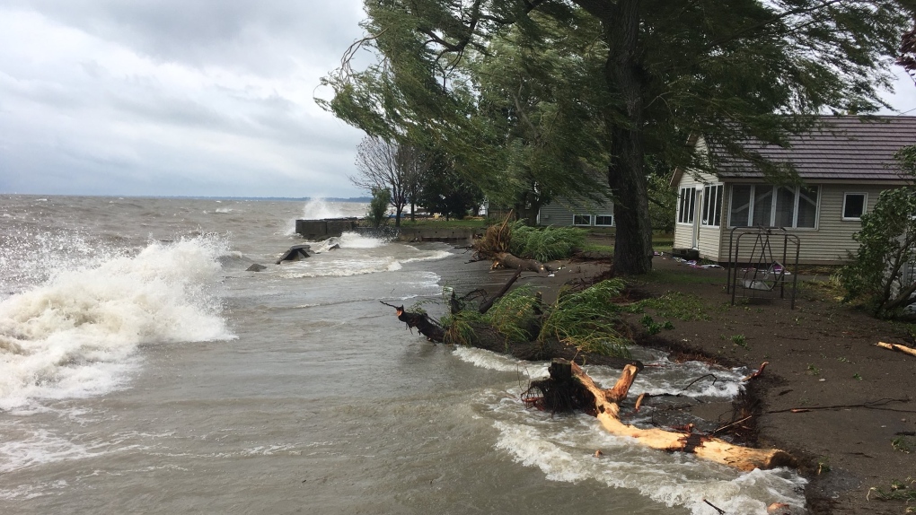
LTVCA says sustained wind speeds above moderate can create waves that cause flooding, erosion, and shoreline damage.
The risk of wave spray flooding, along the shorelines of both lakes, will continue until the lakes freezes over.
The risk of erosion and damage to shoreline protection works on both lakes, including erosion along the high bluffs, will also continue until the lakes freeze over for the winter.
When temperatures drop, but before the lakes freeze over, there is a risk of icy conditions in shoreline areas when wave spray and flood waters freeze.
LTVA says strong winds out of any direction could have an impact on some areas along local shorelines. In the most vulnerable areas, such as Erie Shore Drive in Chatham-Kent, wave spray related flooding can begin at sustained wind speeds as low as 30 km/hr, while other less vulnerable areas may need wind speeds closer to 45 km/hr.
The conservation authority says the outlook is a standing message issued for the month of January. If weather forecasts suggest a sustained wind event likely to cause shoreline issues, the message will be upgraded.


