Heat Warning sticks around in Windsor-Essex, Chatham-Kent
 (Source: Kristy-Lynne Ramsdale)
A heat event continues Tuesday in the region.
According to Environment Canada, maximum temperatures are expected to be between 30 and 33 C, while minimum temperatures are expected to be between 20 and 22 C. Humidex values will be in the high 30s to low 40s.
Cooler temperatures are expected by Wednesday.
The public is reminded to drink plenty of water regularly, even before you feel thirsty to decrease your risk of dehydration and never leave people, particularly children, or pets inside a parked vehicle.
Here's a look at the rest of the forecast
Tuesday: A mix of sun and cloud with 30 per cent chance of showers and risk of a thunderstorm. Fog patches dissipating this morning. Wind becoming southwest 30 km/h gusting to 50 this morning. High 33. Humidex 44. UV index 8 or very high.
Tuesday Night: Partly cloudy with 60 per cent chance of showers or thunderstorms. Wind becoming west 30 km/h gusting to 50 then light after midnight. Low 21.
Wednesday: Mainly cloudy with 30 per cent chance of showers and risk of a thunderstorm. High 29. Humidex 38. UV index 7 or high.
Thursday: A mix of sun and cloud with 30 per cent chance of showers. High 26.
Friday: Cloudy with 60 per cent chance of showers. High 29.
Saturday: Sunny. High 28.
Windsor Top Stories
-
-
-
-
-
-
 LIVE UPDATES
LIVE UPDATES Air Canada flights could halt next week: Here's the latest
-
-


CTVNews.ca Top Stories

Air Canada travellers share worries and frustrations ahead of possible pilot strike
Here's what customers had to say about their travel plans ahead of a potential Air Canada pilot strike.
Trudeau says Ukraine can strike deep into Russia with NATO arms, Putin hints at war
Prime Minister Justin Trudeau says Ukraine should be allowed to strike deep inside Russia, regardless of Moscow threatening that this would draw Canada and its allies into direct war.
Driver charged with killing NHL's Johnny Gaudreau and his brother had .087 blood-alcohol level
The driver charged with killing NHL hockey player Johnny Gaudreau and his brother Matthew as they bicycled on a rural road had a blood-alcohol level of .087, above the .08 legal limit in New Jersey, a prosecutor said Friday.
Ontario's top court dismisses application for bail from Jacob Hoggard
Jacob Hoggard will remain behind bars while he tries to appeal his sexual assault conviction at Canada's top court, a justice with Ontario's Appeal Court ruled Friday, calling the musician's attempt unlikely to succeed.
2 suspects charged after Lamborghini stolen in armed home invasion in Richmond Hill: police
York Regional Police say they have arrested two suspects and are looking for at least one more following an armed home invasion in Richmond Hill that saw thieves escape in the victim’s Lamborghini.
Stuck-in-space astronauts make first public comments since Boeing capsule left without them
Stuck-in-space astronauts Butch Wilmore and Suni Williams said Friday they appreciated all the prayers and well wishes from strangers back home.
Former NHL enforcer Stephen Peat dies after being hit by car in B.C.
Stephen Peat, the former Washington Capitals enforcer who fought concussion issues and was homeless at times after leaving hockey, has died from injuries sustained late last month when he was struck by a car while crossing a street. He was 44.
A cat named Drifter is safe after sneaking out and getting trapped in a sewer for nearly 8 weeks
A cat aptly named Drifter is safe at home after sneaking outside and getting trapped in a sewer for nearly eight weeks.
LIVE UPDATES
LIVE UPDATES Air Canada flights could halt next week: Here's the latest
Air Canada's potential work stoppage could ground flights, halt cargo and leave travellers scrambling to reschedule next week. Follow along with live updates here.
Shopping Trends
The Shopping Trends team is independent of the journalists at CTV News. We may earn a commission when you use our links to shop. Read about us.


Kitchener
-

Councillor questions approval process following 100 complaints about Cambridge event
More than 100 noise complaints were made about a recent late night event at Riverside Park in Cambridge, leading one councillor to question why it was approved in the first place.
-
Senior cyclist who died in hit-and-run in Guelph identified
Tributes to Susan Bard have been popping up online after she died in a hit-and-run crash in Guelph last week.
-
'I was scared:' Ontario woman who lost $158K in roofing scam says she was told her home might collapse
An Ontario woman who just wanted to get some gutter guards to keep leaves out of her eavestroughs said she was convinced her home was going to collapse and handed over $158,000 in a roofing scam.
London
-

Pedestrian in stable condition following serious Richmond Street collision
A pedestrian injured in an early morning collision on Thursday is now in stable condition after sustaining serious injuries.
-
Air Canada passengers from London and elsewhere advised to start making alternate arrangements
Time is running out on a potential work stoppage by Air Canada pilots - that means passengers flying from London International Airport or Toronto Pearson Airport may have to start considering alternate travel plans.
-
Fatal crash involving motorcyclist in Norfolk County
OPP are investigating the cause of a crash that killed a 23-year-old from Oxford County.
Barrie
-

Ont. police officer's spouse charged in historical sexual assault case involving a child
CTV News is learning more about disturbing allegations of sexual assault from 14 years ago in Beeton involving the husband of a Peel Regional police officer.
-
Indoor pickleball facility to open at Georgian Mall
Pickleball fever is taking over the City of Barrie, with its first state-of-the-art indoor pickleball facility in the former Sears site at Georgian Mall.
-
Loaded gun seized, 5 arrested in Collingwood police raid
Five Collingwood residents were arrested and a loaded handgun seized following an early morning police raid on Thursday.
Northern Ontario
-

Driver charged with killing NHL's Johnny Gaudreau and his brother had .087 blood-alcohol level
The driver charged with killing NHL hockey player Johnny Gaudreau and his brother Matthew as they bicycled on a rural road had a blood-alcohol level of .087, above the .08 legal limit in New Jersey, a prosecutor said Friday.
-
Canadian health regulators ban this common food additive. Here's what you need to know
In a move to safeguard public heath, Health Canada has officially banned the use of brominated vegetable oil (BVO) as a food additive. Here's what you need to know.
-
Police seize sawed-off shotgun, ammo, northern Ont. teen charged
A northern Ontario teen has been charged with several weapon offences after police responded to a report of a prohibited weapon at a Kapuskasing residence.
Sault Ste. Marie
-
Sault woman accused of scratching, kicking and hitting employees with purse
A 36-year-old woman is facing assault charges after some unruly behaviour towards staff at Sault Ste. Marie building.
-
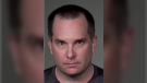
Sault police charge man, 30, with assault and making threat
A 30-year-old suspect is being held in custody on criminal charges in Sault Ste. Marie after an argument escalated Thursday afternoon.
-
One person in custody after Sault police respond to gun call Thursday
One person remains in custody and officials are searching for an aggressive dog that was subdued with a stun gun, Sault police said Thursday evening.
Ottawa
-

Somali community alarmed after police officers wiretapped, watched
Members of Ottawa's Somali community came together Thursday to denounce the Ottawa police use of wiretaps and video surveillance on five of its own Black officers of Somali decent and their family members.
-
Yearlong criminal trial of 'Freedom Convoy' organizers comes to an end
After 45 days of evidence and legal arguments the criminal trial of 'Freedom Convoy' organizers Tamara Lich and Chris Barber is finally at an end.
-
One person dead after stabbing in the ByWard Market
A man is dead following a late night stabbing in Ottawa's ByWard Market, according to the Ottawa Police Service.
Toronto
-

Ontario's public broadcaster under scrutiny for funding, then pulling Russian war doc
Ongoing controversy over the documentary "Russians at War" has brought scrutiny to Ontario’s public broadcaster, which has said it will not air the film it helped fund.
-
Toronto high school remain under hold and secure after shots fired near Oakwood and St. Clair
Toronto police are investigating after area gunfire caused a midtown high school to briefly be placed under lockdown Friday afternoon.
-
Ontario's top court dismisses application for bail from Jacob Hoggard
Jacob Hoggard will remain behind bars while he tries to appeal his sexual assault conviction at Canada's top court, a justice with Ontario's Appeal Court ruled Friday, calling the musician's attempt unlikely to succeed.
Montreal
-
Former West Island baseball coach guilty of sexual assault on 13-year-old boy
Former West Island baseball coach Robert Litvack has been found guilty of sexually assaulting a minor he was hired to train.
-
Quebec again calls for the resignation of federal representative to combat Islamophobia
Quebec is calling for the departure of Canada's special representative responsible for combating Islamophobia, Amira Elghawaby.
-
Presidents Cup golf tournament means traffic headaches for Ile Bizard residents
The Presidents Cup golf tournament is coming to Montreal's Ile Bizard, and with just two weeks to go and preparations underway, many residents are not happy at the thought of the incoming traffic congestion.
Winnipeg
-

1 dead, 3 injured in Friday morning crash on Portage Avenue
One person has died and three people were injured following a crash involving a vehicle and a pedestrian at a Portage Avenue intersection Friday morning.
-
Manitoba accused of ‘wasting taxpayers' money’ with electric vehicle chargers
An advocacy group says the Manitoba government has spent nearly a third of a million dollars on electric vehicle (EV) chargers in the past two years – but hasn’t tracked if the chargers are actually being used.
-
LIVE UPDATES
LIVE UPDATES Air Canada flights could halt next week: Here's the latest
Air Canada's potential work stoppage could ground flights, halt cargo and leave travellers scrambling to reschedule next week. Follow along with live updates here.
Edmonton
-

'Better late than never': Alberta glad B.C. premier has changed stance on carbon tax
The Government of Alberta was glad to hear that British Columbia’s premier has changed his tune on the consumer carbon tax at the provincial level.
-
Jasper state of local emergency ending; visitors asked to be respectful
Jasper is ending its local state of emergency as it gets ready to welcome back visitors and tourists.
-
Alberta town adopts new resident code of conduct to address staff safety
An Alberta town has laid out rules for how residents must treat municipal staff and the consequences if they step out of line.
Calgary
-
'Better late than never': Alberta glad B.C. premier has changed stance on carbon tax
The Government of Alberta was glad to hear that British Columbia’s premier has changed his tune on the consumer carbon tax at the provincial level.
-
Driver charged with killing NHL's Johnny Gaudreau and his brother had .087 blood-alcohol level
The driver charged with killing NHL hockey player Johnny Gaudreau and his brother Matthew as they bicycled on a rural road had a blood-alcohol level of .087, above the .08 legal limit in New Jersey, a prosecutor said Friday.
-
Dazzling outdoor light festival returns to Calgary this month
Calgary's Night Light festival returns later this month with vivid outdoor light installations.
Regina
-

Saskatchewan artist fundraising to help family whose son has genetic disease
A Regina based artist is using his platform to fundraise for the family of a young boy with a genetic disease.
-
Regina Pats' Whitehead becomes first CHL player to verbally commit to NCAA
Regina Pats' forward Braxton Whitehead has become the first major junior hockey player to verbally commit to playing in the Division 1 NCAA ranks after his Western Hockey League career ends.
-
Yearlong criminal trial of 'Freedom Convoy' organizers comes to an end
After 45 days of evidence and legal arguments the criminal trial of 'Freedom Convoy' organizers Tamara Lich and Chris Barber is finally at an end.
Vancouver
-

64 charges laid against alleged 'prolific property crime offender' in Surrey, RCMP say
An alleged prolific property crime offender is accused of committing more than 60 offences across the Lower Mainland in the span of just over a month, according to Surrey RCMP.
-
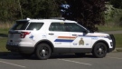
Police investigating suspicious death in Nanaimo, B.C.
Mounties have launched a suspicious death investigation after a man was found dead Thursday in Nanaimo, B.C.
-
Disruptions expected at YVR amid looming Air Canada strike
Airports across the country are experiencing turbulence as a looming strike by Air Canada workers threatens travel plans.
Vancouver Island
-
Police investigating suspicious death in Nanaimo, B.C.
Mounties have launched a suspicious death investigation after a man was found dead Thursday in Nanaimo, B.C.
-
Canada to deploy military patrol plane, 50 personnel to Japan
Canada will send a military patrol plane and approximately 50 personnel to Japan this month to support international sanctions on North Korea following that country's recent ballistic missile tests, Defence Minister Bill Blair announced Friday.
-
Rescue operation frees humpback whale off northern B.C.
A humpback whale was so entangled in fishing gear, ropes and buoys that it took four days for a Fisheries Department crew to unravel the mess, Paul Cottrell said.
Atlantic
-
 UPDATED
UPDATED Missing N.S. woman believed dead; man charged with first-degree murder
Police in Nova Scotia now believe a woman reported missing earlier this month is dead, and a man has been charged with murder in her disappearance.
-
Big drop in gas prices across the Maritimes
The price of gas dropped across the Maritimes overnight, while there was no change in the price of diesel on Prince Edward Island.
-
Call that ended in fatal shooting of Indigenous man was not a wellness check: N.B. RCMP
The assistant commissioner for the New Brunswick RCMP released a statement Thursday evening in regards to a police shooting over the weekend that resulted in the death of a man from Elsipogtog First Nation.
N.L.
-

Newfoundland and Labrador monitoring rise in whooping cough cases: medical officer
Newfoundland and Labrador's chief medical officer is monitoring the rise of whooping cough infections across the province as cases of the highly contagious disease continue to grow across Canada.
-
Dispute over unrecognized Inuit group halts major conference for Canadian North
A 16-year-old biennial event aimed at fostering business in the country's eastern Arctic and northern regions has been cancelled indefinitely as a dispute unfolds between Inuit in Canada and a Labrador group claiming to share their heritage.
-
Cow cuddling: Why a Newfoundland farm is offering quality time with these 'gentle creatures'
Jim Lester’s farm hopped on the cow-cuddling trend in early August, and his time slots have been pretty well sold out ever since.


