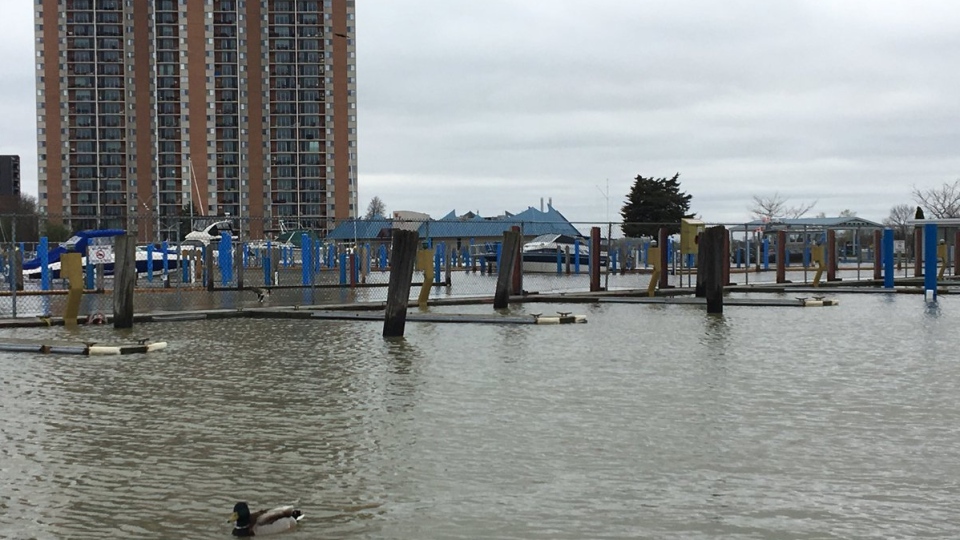
The Essex Region Conservation Authority says a flood watch is in effect for the shoreline areas along Lake Erie, Lake St. Clair, and the Detroit River, as well as lake/river tributaries.
Forecasts are predicting back-to-back wind events starting with wind out of the north/northeast on Tuesday, followed by significant wind out of the northeast on Wednesday.
According to the United States Army Corps of Engineers, both Lake St. Clair and Lake Erie have started the month of May with water levels above their respective record high monthly average water levels for May set in 1986.
Due to these high levels, there is increased concern related wind-generated lake-setup, damaging waves, and shoreline erosion.
The City of Windsor is moving forward with plans to make sand and sandbags available to residents in the area of greatest risk of flooding at this time.
These homes are located along the north side of Riverside Drive from Goose Bay Park east to the border with the Town of Tecumseh.
Residents from those addresses will be able to pick up their sandbags and sand beginning Wednesday morning and will have to provide proof of address to receive the materials.
Details on pickup location and times are being finalized and will be announced Tuesday via local media, City of Windsor social media channels and the City of Windsor website.
Tuesday’s wind event out of the north/northeast may be similar to last Friday, which elevated Lake St. Clair water levels and generated significant wave action.
With a similar forecast, there is again the possibility for elevated water levels on Lake St. Clair with the potential for flooding, shoreline erosion, and damaging waves along the north shore of the Region including Windsor, Tecumseh, and Lakeshore.
ERCA says this particular wind event also has the potential to raise water levels in Lake St. Clair tributaries.
By Wednesday morning, forecasts are predicting for winds to shift out of the northeast, increasing in speeds throughout the day reaching sustained speeds above 30 km/hr and gusts above of 40 km/hr for an extended period of time.
These winds are not expected to subside or shift until Thursday. If this forecast remains accurate, there is a high possibility of flooding, shoreline erosion and damaging waves.
These types of wind events have the potential to significantly raise water levels in the western basin of Lake Erie, Lake St. Clair, as well as elevate water levels in the Detroit River and major tributaries across the Region.
Due to the current high water levels along Lake St. Clair, the City of Windsor should monitor water levels along the flood control dikes within the Little River Drain corridor.
Due to the predicted northeast winds and elevated lake level, the Municipality of Leamington should monitor the flood control dikes in the Southeast Leamington Area.
The lower portions of the Marentette Beach Road dike that provides protection for the inland Marentette dike has sustained damage from recent storms through April 2019.
Due to the damage sustained to the outer layer of protection, the interior corner of the Marentette dike is more exposed to direct wave impact from Lake Erie, increasing its susceptibility to erosion and risk to flooding.
The municipality is actively working to assess the damage to coordinate corrective actions to restore an appropriate level of protection.
The flood watch is in effect until 12 p.m. on Thursday.


