Weather statement in effect for entire region
All of southern Ontario is covered by a special weather statement Friday morning.
From Windsor-Essex and Chatham-Kent through London-Middlesex and all the way to Cornwall, the statement warns of strong winds with gusts up to 70 km/h and 80 k m/h ahead of a cold front.
The high winds are expected to last through Saturday afternoon and people are being warned about possible power outages.
Friday: Mainly cloudy. Wind becoming south 30 km/h gusting to 50 this morning. High 6.
Friday Night: Cloudy. 40 per cent chance of showers overnight. Wind south 20 km/h gusting to 40 becoming southwest 40 gusting to 70 after midnight. Temperature rising to 9 by morning.
Saturday: Showers ending in the morning then cloudy. Wind southwest 40 km/h gusting to 70 becoming northwest 50 gusting to 70 late in the morning then west 30 gusting to 50. Temperature falling to zero in the afternoon.
Sunday: Sunny. High plus 3.
Monday: Increasing cloudiness. High plus 5.
Tuesday: Cloudy with 40 per cent chance of showers. High 6.
Wednesday: A mix of sun and cloud. High plus 2.
Thursday: A mix of sun and cloud. High minus 3.


CTVNews.ca Top Stories

MPP Sarah Jama asked to leave Ontario legislature for wearing keffiyeh
MPP Sarah Jama was asked to leave the Legislative Assembly of Ontario by House Speaker Ted Arnott on Thursday for wearing a keffiyeh, a garment which has been banned at Queen’s Park.
Mountain guide dies after falling into a crevasse in Banff National Park
A man who fell into a crevasse while leading a backcountry ski group deep in the Canadian Rockies has died.
B.C. tenants evicted for landlord's use after refusing large rent increase to take over neighbouring suite
Ashley Dickey and her mother rented part of the same Coquitlam duplex in three different decades under three different landlords.
Expert warns of food consumption habits amid rising prices
A new survey by Dalhousie University's Agri-Food Analytics Lab asked Canadians about their food consumption habits amid rising prices.
Saskatchewan isn't remitting the carbon tax on home heating. Why isn't my province following suit?
After Prime Minister Justin Trudeau said the federal government would still send Canada Carbon Rebate cheques to Saskatchewan residents, despite Saskatchewan Premier Scott Moe's decision to stop collecting the carbon tax on natural gas or home heating, questions were raised about whether other provinces would follow suit. CTV News reached out across the country and here's what we found out.
Montreal actress calls Weinstein ruling 'discouraging' but not surprising
A Montreal actress, who has previously detailed incidents she had with disgraced Hollywood producer Harvey Weinstein, says a New York Court of Appeals decision overturning his 2020 rape conviction is 'discouraging' but not surprising.
RCMP officers had no legal authority to enter man's home, make arrest: B.C. court
A B.C. man has been found not guilty of assaulting two RCMP officers – with the court finding he was resisting an "unlawful entry and arrest" in his home before he was tasered, taken down and hauled away in handcuffs.
Body of Quebec man who died in Cuba found in Russia, family confirms
A Montreal-area family confirmed to CTV News that the body of their loved one who died while on vacation in Cuba is being repatriated to Canada after it was mistakenly sent to Russia.
'Deep ignorance': Calls for Manitoba trustee to resign sparked after comments about Indigenous people and reconciliation
A rural Manitoba school trustee is facing calls to resign over comments he made about Indigenous people and residential schools earlier this week.
Shopping Trends
The Shopping Trends team is independent of the journalists at CTV News. We may earn a commission when you use our links to shop. Read about us.


Kitchener
-

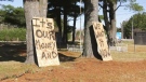
Generational farm could be impacted if Wilmot land assembly goes ahead
A family of farmers say their operations would be significantly impacted if the Region of Waterloo goes ahead with a land assembly project in the Wilmot Township area.
-
Former Kitchener doctor accused of sexually assaulting patients makes brief court appearance as marathon trial continues
The trial for former neurologist Jeffrey (Scott) Sloka began two and a half years ago, and it remains unclear when there may be a verdict.
-
Drivers who got bad fuel from Guelph, Ont. gas station receiving compensation
Drivers who were hit with hefty repair bills after fueling up at a Guelph gas station appear to be finally getting their money back.
London
-

Legendary hockey broadcaster Bob Cole dies at 90: CBC
Bob Cole, a welcome voice for Canadian hockey fans for a half-century, has died at the age of 90. Cole died Wednesday night in St. John's, N.L., surrounded by his family, his daughter, Megan Cole, told the CBC.
-
A First Nations young female hockey player bears the Toronto Maple Leafs’ flag before playoff game
Madison Maness had the chance to do something not many people get to do.
-
Laid off workers seeking severance say 'Shame on Wescast'
A crowd of former Wescast employees and supporters rallied outside Wescast Industries in Wingham, Ont. on Thursday, requesting the severance pay they're owed.
Barrie
-

Honda unveils $15B investment plan to build new EV plant in Alliston
Prime Minister Justin Trudeau and Premier Doug Ford visited Alliston on Thursday to unveil a $15 billion investment in an electric vehicle and battery facility.
-
Secret $70M Lotto Max winners break their silence
During a special winner celebration near their hometown, Doug and Enid shared the story of how they discovered they were holding a Lotto Max ticket worth $70 million and how they kept this huge secret for so long.
-
Kempenfest announces its most impressive lineup yet for its 52nd year
A popular summer festival on the Barrie waterfront is returning for its 52nd year, with one of the most impressive lineup yet.
Northern Ontario
-

Former head of Ont. tech company charged in $6M fraud case
A years-long fraud investigation by the Ontario Provincial Police’s anti-rackets branch has resulted in fraud and other charges for the former head of BioNorth Technology Group, Frank Benincasa
-
Secret $70M Lotto Max winners break their silence
During a special winner celebration near their hometown, Doug and Enid shared the story of how they discovered they were holding a Lotto Max ticket worth $70 million and how they kept this huge secret for so long.
-
Fire victims in Timmins say thieves have stolen their personal belongings
A month after an accidental fire forced more than 100 people out of their apartments at the Empire Complex in Timmins, residents are now dealing with being victims of theft.
Sault Ste. Marie
-
Garden River chief meets with disgruntled band members over payout concerns
Some members of the Garden River First Nation are demanding answers regarding the disbursement of the Robinson-Huron Treaty settlement funds.
-
OPP and Treaty Three police lay murder charge in northwestern Ont.
The Ontario Provincial Police, in partnership with the Treaty Three Police Service, have charged a suspect with murder following a homicide in a remote northwestern Ontario community.
-
Youth charged in the Sault for firing cap gun at passersby
A 15-year-old in Sault Ste. Marie has been charged following an incident on Bay Street on Tuesday.
Ottawa
-

Criminal charge laid in 2023 hedge trimming death; company owner pleads guilty to Ministry of Labour charge
The supervisor of a 20-year-old man who died after he was electrocuted while trimming hedges in Manotick in May 2023 has been charged with criminal negligence causing death. Meanwhile, the company owner has pleaded guilty to a charge laid by the Ministry of Labour.
-
More Canadians eating food past 'best before' dates as costs rise
As the cost of groceries increases, more Canadians are willing to go past the best before dates on food. A recent study out of Dalhousie University's Agri-Food Analytics Lab surveyed 9,109 Canadians to see how they are managing food safety risks.
-
Here is where Ottawa's newest roundabout is planned and why OC Transpo says it's needed
Love them or hate them, roundabouts are found all-around the city, but a plan to a replace an Orléans intersection with one has some residents upset.
Toronto
-
Suspect, 3 persons of interest sought after man falls to death from downtown Toronto balcony
Toronto police say the homicide unit is investigating after a man was reportedly pushed to his death from a balcony downtown late Wednesday night.
-
MPP Sarah Jama asked to leave Ontario legislature for wearing keffiyeh
MPP Sarah Jama was asked to leave the Legislative Assembly of Ontario by House Speaker Ted Arnott on Thursday for wearing a keffiyeh, a garment which has been banned at Queen’s Park.
-
Man shot and killed in violent home invasion at Etobicoke townhouse, police say
Toronto police say they are searching for three suspects after a man was shot and killed inside an Etobicoke townhouse during what investigators have described as a violent home invasion.
Montreal
-

'There's really no justice': Quebec mother, daughter speak out after man gets house arrest for years of abuse
A mother and daughter are speaking out after a Quebec man was sentenced to house arrest for years of domestic abuse. They were both physically assaulted by the mother's ex-partner and say the offender got off with another light sentence.
-
Body of Quebec man who died in Cuba found in Russia, family confirms
A Montreal-area family confirmed to CTV News that the body of their loved one who died while on vacation in Cuba is being repatriated to Canada after it was mistakenly sent to Russia.
-
Former Montreal baseball coach accused of sex assault on minor loses bid to throw out case
The trial of a West Island baseball coach accused of sexually abusing a minor will proceed after the case was almost thrown out due to unreasonable delays.
Winnipeg
-

'Deep ignorance': Calls for Manitoba trustee to resign sparked after comments about Indigenous people and reconciliation
A rural Manitoba school trustee is facing calls to resign over comments he made about Indigenous people and residential schools earlier this week.
-
Former Manitoba premier Heather Stefanson leaving politics after 23 years
Former Manitoba premier Heather Stefanson is resigning her legislature seat and leaving political life.
-
Arrest made in 2021 northern Manitoba double homicide: RCMP
Manitoba RCMP have arrested a suspect in relation to a 2021 double homicide in a remote northern community.
Edmonton
-

UCP able to remove councillors and axe city bylaws in new sweeping bill aimed at municipal politics
The Government of Alberta wants to change how municipalities handle elections and local politics.
-
Experts urge Albertans to check measles vaccine status after confirmed Edmonton case
A confirmed case of measles in Edmonton has prompted another plea from health officials for people to make sure vaccinations are up to date.
-
Person rescued from burning balcony of downtown Edmonton apartment building
One person was rescued from a burning building in Edmonton on Thursday.
Calgary
-

Calgary CO call in Brentwood sends 7 people to hospital
Seven people were taken to Calgary hospitals on Thursday for carbon monoxide exposure.
-
RCMP investigating homicide in Gleichen, Alta.
The RCMP major crimes unit is investigating after a man was killed in Gleichen, Alta., on Wednesday evening.
-
Mountain guide dies after falling into a crevasse in Banff National Park
A man who fell into a crevasse while leading a backcountry ski group deep in the Canadian Rockies has died.
Regina
-

'Get these doctors here': Sask. family calls on province to step up gastroenterologist recruitment
The Weber family is being forced to travel to Toronto due to a lack of pediatric gastroenterologists (GIs) in the province. The family’s situation was highlighted by Saskatchewan’s official opposition.
-
Looking ahead to the upcoming CFL Draft
The draft will take place on Tuesday, April 30, the Saskatchewan Roughriders currently hold the third overall pick.
-
Sask. to continue work twinning highways from Regina to Milestone area
Work to twin Highways 6 and 39 from Regina to near Milestone will continue this year, with the province expecting construction to resume as early as May.
Vancouver
-

1 injured after vehicle crashes into downtown Vancouver dental office
One person was injured after a vehicle crashed through the front window of a dental clinic in downtown Vancouver Thursday.
-
Canucks watch party, Richmond Night Market and more happening in Metro Vancouver this weekend
The final weekend of April sees the Canucks in Nashville for Games 3 and 4 of their playoff series against the Predators, plus the opening weekend of the Richmond Night Market and B.C.'s largest Earth Day celebration in Surrey.
-
RCMP officers had no legal authority to enter man's home, make arrest: B.C. court
A B.C. man has been found not guilty of assaulting two RCMP officers – with the court finding he was resisting an "unlawful entry and arrest" in his home before he was tasered, taken down and hauled away in handcuffs.
Vancouver Island
-

Hiker airlifted to hospital in critical condition after falling into Vancouver Island canyon
A hiker was airlifted to hospital in critical condition Tuesday after he fell approximately 60 metres into a canyon on Vancouver Island.
-
B.C. civil lawsuit against Sex Pistols guitarist alleges 1980 sexual assault
A Vancouver woman has filed a civil lawsuit against Paramount Pictures Corp. and punk rocker Stephen Jones of The Sex Pistols alleging he sexually assaulted her as a teenager while she was a movie extra more than 40 years ago.
-
Harbour Air commits to buying 50 electric engines for seaplane fleet
Harbour Air is travelling towards a more sustainable future, looking to electrify its fleet of 45 aircraft.
Atlantic
-

'They followed their gut': N.B. RCMP say wellbeing check led to rescue of human trafficking victims
The New Brunswick RCMP say a wellbeing check that led to the rescue of three women from alleged human trafficking in Moncton earlier this month was the result of someone following their gut.
-
2 teens charged in Halifax homicide: police
Two teenagers have been charged with second-degree murder in connection to an alleged homicide near the Halifax Shopping Centre earlier this week.
-
N.S. residents arrested at New Brunswick border with multiple weapons
Canadian Border Services Agency (CBSA) officers arrested two Nova Scotia residents at the New Brunswick border after they seized multiple prohibited firearms.
N.L.
-

Made-in-Newfoundland vodka claims top prize at worldwide competition
A Newfoundland-made vodka has been named one of the world’s best by judges at this year’s World Vodka Awards.
-
Rideshare platform Uber expands to Newfoundland and Labrador
Uber Technologies Inc. says it has brought its ridesharing platform to Newfoundland and Labrador.
-
Newfoundland director found creeping terror of 'The King Tide' in a tiny coastal town
Newfoundlander Christian Sparkes has shot several films around his home province, but with his new psychological thriller 'The King Tide' he saw an opportunity to wander into one unique town that had eluded him over the years.


