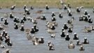
Special Weather Statement in effect
A special weather statement form Environment Canada blankets all of southern Ontario on Tuesday.
For Windsor-Essex, strong winds are expected into Wednesday night – some gusting upwards of 80 km/h.
The strongest winds are expected near the eastern shores of the Great Lakes where wind gusts up to 90 km/h may occur.
The weather authority is warning that strong winds may toss loose objects and cause tree branches to break and that isolated utility outages may occur.
Tuesday: Mainly cloudy. Wind becoming southeast 30 km/h gusting to 50 this morning. High 9.
Tuesday Night: Cloudy. Periods of rain beginning this evening. Risk of a thunderstorm late this evening and after midnight. Amount 10 to 20 mm. Wind south 40 km/h gusting to 60. Low 6.
Wednesday: Periods of rain ending in the morning then cloudy. A few flurries beginning in the afternoon. Wind south 40 km/h gusting to 60 becoming west 40 gusting to 70 in the morning. Temperature falling to minus 2 in the afternoon. Wind chill minus 10 in the afternoon.
Thursday: A mix of sun and cloud. High plus 2.
Friday: A mix of sun and cloud. High 7.
Saturday: A mix of sun and cloud with 60 percent chance of showers. Windy. High 6.
Sunday: Cloudy with 60 percent chance of showers. High plus 5.


CTVNews.ca Top Stories

LIVE NOW
LIVE NOW Budget 2024 prioritizes housing while taxing highest earners, deficit projected at $39.8B
In an effort to level the playing field for young people, in the 2024 federal budget, the government is targeting Canada's highest earners with new taxes in order to help offset billions in new spending to enhance the country's housing supply and social supports.
BREAKING
BREAKING Feds cutting 5,000 public service jobs, looking to turn underused buildings into housing
Five thousand public service jobs will be cut over the next four years, while underused federal office buildings, Canada Post properties and the National Defence Medical Centre in Ottawa could be turned into new housing units, as the federal government looks to find billions of dollars in savings and boost the country's housing portfolio.
Some of the winners and losers in the 2024 federal budget
With a variety of fiscal and policy measures announced in the federal budget, winners include small businesses and fintech companies while losers include the tobacco industry and Canadian pension funds.
From housing initiatives to a disability benefit, how the federal budget impacts you
From plans to boost new housing stock, encourage small businesses, and increase taxes on Canada’s top-earners, CTVNews.ca has sifted through the 416-page budget to find out what will make the biggest difference to your pocketbook.
Liberals aim to hit the brakes on car theft with new criminal offences
The Liberals are proposing new charges for the use of violence while stealing a vehicle and for links to organized crime, as well as laundering money for the benefit of a criminal organization.
Feds offer $5B in Indigenous loan guarantees, fall $420B short on infrastructure asks
The federal government is providing up to $5 billion in loan guarantees to help Indigenous communities invest in natural resource and energy products. But when it comes to a promise to close what advocates say is a sprawling Indigenous infrastructure gap, Ottawa is short more than $420 billion.
BREAKING
BREAKING Police to announce arrests in Toronto Pearson airport gold heist
Police say that arrests have been made in connection with a $20-million gold heist at Toronto Pearson International Airport one year ago.
Proposed class-action lawsuit against Shoppers Drug Mart alleges 'unsafe and unethical corporate practices'
Shoppers Drug Mart is facing a proposed class-action lawsuit by current and former franchise owners at the retail chain who allege parent company Loblaw engaged in corporate practices that placed them in an “irredeemable conflict of interest” and put patient care at risk.
Lululemon unveils first summer kit for Canada's Olympic and Paralympic teams
Lululemon says it is combining function and fashion in its first-ever summer kit for Canada's Olympians and Paralympians.
Shopping Trends
The Shopping Trends team is independent of the journalists at CTV News. We may earn a commission when you use our links to shop. Read about us.


Kitchener
-

Driveway paving scammers reported in Waterloo Region
Cambridge resident Samantha Falkiner explains why something felt "off" about the men who approached her and her neighbours on Friday.
-
Policing costs for St. Patrick’s Day celebrations in Waterloo increased by $51,000
Waterloo Regional Police Services has released the estimated total cost for the St. Patrick’s Day weekend in the city of Waterloo.
-
Brantford police looking for pickpocket suspects
Brantford police are investigating a series of personal thefts and are seeking information from the public to identify the people responsible.
London
-
 BREAKING
BREAKING Fatal crash on Highway 401 claims 1 life, eastbound lanes closed
A two-vehicle crash between a pickup truck and a transport truck on Highway 401 south of London, Ont. has resulted in one fatality Tuesday afternoon, with police warning motorists to expect delays in the area.
-
'Not worth it': London, Ont. driver charged after travelling nearly 200 km/h on Highway 401
A driver from London will have to find alternative transportation after an OPP officer clocked them travelling nearly 200 km/h on Highway 401 over the weekend.
-
As 'bright as the sun': Students describe house fire near Fanshawe College
A number of students have been displaced after a house fire in east London near Fanshawe College. Crews were called to the scene on Prosperity Court late Monday night.
Barrie
-
Casino Rama adds new shows to its 2024 performance lineup
Two new shows are coming to Casino Rama's Entertainment Centre for fans of country music and 80s rock.
-
Apartment fire linked to battery-operated vacuum cleaner
Fire officials say a lithium-ion battery inside a vacuum cleaner sparked a fire at an apartment complex Sunday afternoon in Gravenhurst.
-
City cracks down on inconsiderate dog owners: Here's ways to avoid a hefty fine
Owen Sound dog owners could face a pretty penny for not leashing their dogs or picking up after them.
Northern Ontario
-

Northern Ont. driver missing after vehicle pulled into creek
Rescue crews are searching for a man reported missing on the weekend after the vehicle he was driving was pulled into a creek near the Quebec border in northern Ontario.
-
YMCA in the Sault ceasing operations next month
The YMCA of Sault Ste. Marie is selling its building and ceasing operations in May.
-
The zipper is back: Early start to road construction season in Sudbury
City officials in Sudbury say construction season started early this year thanks to the warm weather this spring.
Sault Ste. Marie
-

YMCA in the Sault ceasing operations next month
The YMCA of Sault Ste. Marie is selling its building and ceasing operations in May.
-
Sault driver was doing 108 km/h in a 60 km/h zone: police
Police in Sault Ste. Marie have charged a 26-year-old with stunt driving following an incident Tuesday morning.
-
Northern Ont. colleges on impact of international student cap
Here is a look at how some northern Ontario colleges are being affected by the new Canadian immigration policy that has reduced the number of new international students.
Ottawa
-
 BREAKING
BREAKING Feds cutting 5,000 public service jobs, looking to turn underused buildings into housing
Five thousand public service jobs will be cut over the next four years, while underused federal office buildings, Canada Post properties and the National Defence Medical Centre in Ottawa could be turned into new housing units, as the federal government looks to find billions of dollars in savings and boost the country's housing portfolio.
-
LIVE NOW
LIVE NOW Budget 2024 prioritizes housing while taxing highest earners, deficit projected at $39.8B
In an effort to level the playing field for young people, in the 2024 federal budget, the government is targeting Canada's highest earners with new taxes in order to help offset billions in new spending to enhance the country's housing supply and social supports.
-
BREAKING
BREAKING Ottawa police get $50 million to boost security around Parliamentary Precinct
The Ottawa Police Service will receive $50 million in new federal funding over the next five years to "enhance security" around the Parliamentary Precinct.
Toronto
-
 BREAKING
BREAKING Police to announce arrests in Toronto Pearson airport gold heist
Police say that arrests have been made in connection with a $20-million gold heist at Toronto Pearson International Airport one year ago.
-
LIVE NOW
LIVE NOW Budget 2024 prioritizes housing while taxing highest earners, deficit projected at $39.8B
In an effort to level the playing field for young people, in the 2024 federal budget, the government is targeting Canada's highest earners with new taxes in order to help offset billions in new spending to enhance the country's housing supply and social supports.
-
Toronto police monitoring rail line protest
Toronto police say they are monitoring a pro-Palestinian protest blocking railway lines in the city.
Montreal
-

Quebec's refusal to deliver English presentation to parents raises questions about language law
Quebec's education ministry says it is working on clarifying directives on when officials can communicate with the public in a language other than French.
-
Quebec court approves class action alleging opioid makers misled users about risks
A Quebec Superior Court judge has authorized a class-action lawsuit against 16 pharmaceutical companies that are alleged to have misled consumers about the efficacy and dangers of opioid medications.
-
Third referendum: PQ leader's speech is full of 'catastrophism,' says QS
Despite sharing the Parti Quebecois (PQ)'s desire to make Quebec a country, Quebec Solidaire (QS) parliamentary leader Gabriel Nadeau-Dubois has roundly criticized PQ leader Paul St-Pierre Plamondon's speech, calling it 'conservative.'
Winnipeg
-

Teen hockey players arrested for sexual assault following hazing incident: Manitoba RCMP
Three teenagers were arrested in connection with a pair of alleged hazing incidents on a Manitoba hockey team, police say.
-
LIVE NOW
LIVE NOW Budget 2024 prioritizes housing while taxing highest earners, deficit projected at $39.8B
In an effort to level the playing field for young people, in the 2024 federal budget, the government is targeting Canada's highest earners with new taxes in order to help offset billions in new spending to enhance the country's housing supply and social supports.
-
'It's troubling': Winnipeg sports memorabilia store target of three break-ins
One Winnipeg sports memorabilia shop has been the target of multiple break-ins and is now looking to recover some stolen property.
Edmonton
-

Pipeline involved in wildland fire, Yellowhead County says
A pipeline was involved in a wildfire in western Alberta on Tuesday, Yellowhead County says.
-
Ice District watch parties return for Oilers playoffs
The Edmonton Oilers are bringing back watch parties inside and outside Rogers Place when the Stanley Cup Playoffs begin in the coming days.
-
$440K in stolen property recovered by RCMP during rural crime investigation
Three people have been charged after police recovered nearly half a million dollars worth of stolen property.
Calgary
-
Jurors hear closing arguments in trial for three men charged in Coutts blockade
A Crown prosecutor making the case against three men charged with mischief at the border blockade at Coutts, Alta., told jurors Tuesday they don’t have to determine the accused were kingpins of the protest in order find them guilty.
-
LIVE NOW
LIVE NOW Budget 2024 prioritizes housing while taxing highest earners, deficit projected at $39.8B
In an effort to level the playing field for young people, in the 2024 federal budget, the government is targeting Canada's highest earners with new taxes in order to help offset billions in new spending to enhance the country's housing supply and social supports.
-
Calgary police catch driver travelling more than 100 km/h over the speed limit
Calgary police say the driver of a BMW was given a summons for a mandatory court appearance after being caught travelling more than double the speed limit.
Regina
-

Parts of Sask. could see up to 30 centimetres of snow, dangerous driving conditions: ECCC
Winter weather seemed to be in the rear view mirror for Saskatchewan the past couple weeks, but now Environment and Climate Change Canada (ECCC) is forecasting as much as 30 centimetres of snow for some parts of the province.
-
'They want to be at the table': Sask. NDP leader calls for cooperation at SUMA
Saskatchewan NDP Leader Carla Beck highlighted concerns around mental health, addictions and infrastructure as she addressed the Saskatchewan Urban Municipalities Association (SUMA) conference.
-
LIVE NOW
LIVE NOW Budget 2024 prioritizes housing while taxing highest earners, deficit projected at $39.8B
In an effort to level the playing field for young people, in the 2024 federal budget, the government is targeting Canada's highest earners with new taxes in order to help offset billions in new spending to enhance the country's housing supply and social supports.
Vancouver
-

B.C. court upholds conviction after man argues crowds, claustrophobia led to fatal Costco encounter
British Columbia's highest court has upheld a manslaughter conviction against a Vancouver man who shoved a senior outside a busy Costco store, rejecting his argument that the trial judge failed to consider how his claustrophobia and fear of crowds led to the fatal altercation.
-
Relocated seal returns to Greater Victoria after 'astonishing' 204-kilometre trek
A moulting seal who was relocated after drawing daily crowds of onlookers in Greater Victoria has made a surprise return – after what officials described as an "astonishing" six-day journey.
-
LIVE NOW
LIVE NOW Budget 2024 prioritizes housing while taxing highest earners, deficit projected at $39.8B
In an effort to level the playing field for young people, in the 2024 federal budget, the government is targeting Canada's highest earners with new taxes in order to help offset billions in new spending to enhance the country's housing supply and social supports.
Vancouver Island
-
LIVE NOW
LIVE NOW Budget 2024 prioritizes housing while taxing highest earners, deficit projected at $39.8B
In an effort to level the playing field for young people, in the 2024 federal budget, the government is targeting Canada's highest earners with new taxes in order to help offset billions in new spending to enhance the country's housing supply and social supports.
-
B.C. court upholds conviction after man argues crowds, claustrophobia led to fatal Costco encounter
British Columbia's highest court has upheld a manslaughter conviction against a Vancouver man who shoved a senior outside a busy Costco store, rejecting his argument that the trial judge failed to consider how his claustrophobia and fear of crowds led to the fatal altercation.
-
Planning next bid to rescue B.C. orca calf will take 'few days': Fisheries Department
The Department of Fisheries says planning for a new attempt to rescue an orca calf trapped in a Vancouver Island lagoon will be finalized in the next few days but no date has been set.
Atlantic
-

500 Newfoundlanders wound up on the same cruise and it turned into a rocking kitchen party
A Celebrity Apex cruise to the Caribbean this month turned into a rocking Newfoundland kitchen party when hundreds of people from Canada's easternmost province happened to be booked on the same ship.
-
4 people charged in connection with N.S. man’s 2022 death
The Nova Scotia RCMP says four people have been charged following a man’s homicide two years ago.
-
Halifax Transit bus involved in three-vehicle crash in city’s downtown
A portion of Barrington Street has reopened after a three-vehicle crash Tuesday morning.
N.L.
-
500 Newfoundlanders wound up on the same cruise and it turned into a rocking kitchen party
A Celebrity Apex cruise to the Caribbean this month turned into a rocking Newfoundland kitchen party when hundreds of people from Canada's easternmost province happened to be booked on the same ship.
-
Protest averted as Newfoundland and Labrador premier helps reach pricing deal on crab
A pricing agreement has been reached between crab fishers and seafood processors that will allow for Newfoundland and Labrador's annual crab fishery to get started.
-
A fish harvester's protest threatens Newfoundland and Labrador's crab season -- again
Longliners across Newfoundland and Labrador are tied up once again, as a new protest by the province's fish harvesters threatens to derail the crab fishery for a second straight year.


